Investigation drilling
The exploratory drilling method is one of the most important indirect research methods in karst. This method is usually used in research of deeper parts of karst. However, data obtained by exploratory drilling refer only to narrow space around borehole, which can be a problem in non-homogeneous, anisotropic medium such as karst. It is known that geological cross-sections made from core sample from boreholes, which are located only a few meters from each other, can be entirely different. This method can be applied in the initial research stage, but considering high costs, it is often used after basic research, in the final stage, when exploratory wells are projected and realized.
In karst, drilling method is most often used to examine wider regions where concentrated karst aquifer drainage occurs, and to investigate ponors and estavelles zones as well. Suitable locations for boreholes position are determined based on the elements of fault tectonics, lithological contents of medium and by applying other methods such as remote sensing, geophysics methods etc.
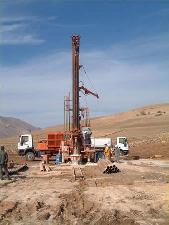
- Photo above: DANDO drilling rig for percussion-rotary drilling, during the drilling of borehole in Northern Iraq (photo by Z. Stevanović)
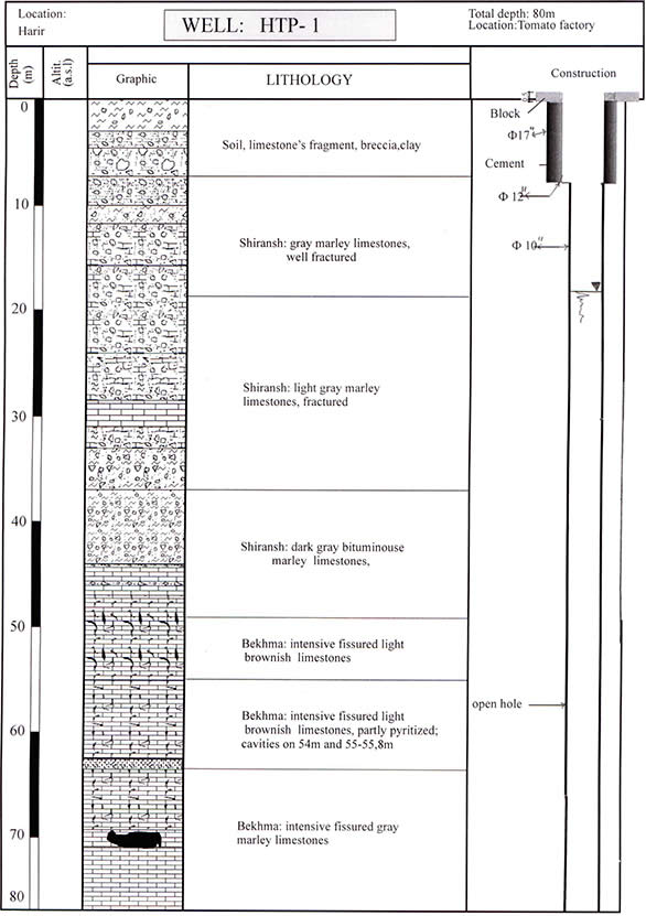
- Sketch below: Cross-section and open-hole well construction rewiev, Creataceous limestones, Northern Iraq (Stevanović & Iurkiewicz, 2004)
From the technical point of view, exploratory drilling in karst should be performed by rotary drilling method with constantly sampling, without clay mud (only water-based mud) and with closing drilling diameter which should not be smaller than 86 mm.
Besides rotary drilling method, well drilling should be performed by percussion drilling method, whose advantages are faster drilling and precise locating of groundwater level.
Special attention should also be paid to deterioration of drilling equipment in caverns, where it is necessary to perform video-logging of karstic channels.
Use of these systems refers primarily to determination of channels dimensions and directions of their stretching, and to medium characteristics (visibility, temperature, water flows etc) as well. Geophysical well logging is performed after completion of the drilling, but before transformation borehole to exploratory well. Use of geophysical well logging provides very useful information regarding physical characteristic of rock down the borehole (Milanović P., 1981), such as: lithological contents of medium, water permeability, temperature of water and rock, groundwater flow velocity and direction etc. In geophysical well logging research in karst, the most commonly applied geophysical methods are: resistivity logging (measurement of electrical resistivity of water in borehole), caliper log (determination of change of well diameter, location and size of cavern), gamma ray logging (determination of density and porosity of karstificated rocks) and temperature log (Anđelković, 1976).